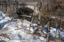

 Surface water (or storm water): water that you find in streams, ponds, lakes, etc., or runoff from roofs, lawns, streets and parking lots. Precipitation replenishes surface water. Surface water evaporates, runs off the land and ultimately reaches a body of water, or it seeps into the ground.
Watershed: Everyone lives in a watershed, and in reality, in multiple watersheds. A watershed is simply an area where water drains to a waterway. The watershed boundary is the dividing line of highest elevation surrounding a given stream or network of streams. Rainwater falling outside the boundary will flow into an adjacent watershed and another water body.
If you live in the Lauraville section of Baltimore, the water that falls on your property drains into the Herring Run Watershed, which is part of the Back River Watershed, which is part of the Chesapeake Bay Watershed, which is part of the Atlantic Ocean Watershed.
Surface water in your watershed should be kept as clean as possible. Clean watersheds mean:
Patapsco and Back River Basin
The Patapsco and Back River are tributaries of the Chesapeake Bay. Nutrient and sediment pollution degrades the watershed aquatic life. Excess nutrients and sediments are the primary sources of pollution in the Chesapeake Bay. Nutrients occur naturally in soil, animal waste, plants, and the atmosphere; but in the Chesapeake Bay watershed, urbanization and farming have increased nutrient loads to unhealthy levels.
The Patapsco/Back River basin drains approximately 630 square miles of land, including all of Baltimore City and portions of Anne Arundel, Baltimore, Carroll, and Howard Counties. Larger water bodies in the basin include Back River, Gwynns and Jones Falls, the North and South Branches of the Patapsco River, Lake Roland, Piney Run Reservoir, Liberty, Loch Raven and Prettyboy Reservoirs, and the Baltimore Harbor, a tidal embayment formed at the confluence of the Patapsco River and the Jones and Gwynns Falls. The Patapsco and the Back Rivers affect the Chesapeake with nutrient pollution. Point source (single, definable location, such as a wastewater treatment plant or industrial discharge) and non-point source pollution (general runoff from land and atmospheric deposition) pollute our water. Non-point runoff from different land uses, point sources, and atmospheric deposition are the sources of nutrient pollution within the Bay watershed.
Jones Falls Watershed: The Jones Falls watershed encompasses 58 square miles including rural segments of Baltimore County at its upper reaches. The stream meanders through increasing levels of development until it emerges from a tunnel at Baltimore City’s Inner Harbor.
Herring Run Watershed: The 31 square mile watershed has its headwaters in Towson, Maryland, and flows through Baltimore City and County before discharging into the Back River, which empties into the Chesapeake Bay. The principal tributaries of the Herring Run are the Western Branch, Chinquapin Run, Tiffany Run, Armistead Run, Biddison Run, Moore’s Run, and Redhouse Run. The total length of the Herring Run main stem and tributaries is over 41 miles (66 km)
Gwynns Falls Watershed: Gwynns Falls is a stream in Baltimore County and Baltimore City, Maryland. The headwaters are located in Reisterstown and the stream flows southeast for about 14 miles (23 km) to Baltimore, emptying into the Middle Branch of the Patapsco River, which drains to the Baltimore Harbor. The watershed area of Gwynns Falls is 66 square miles.
Baltimore Harbor Watershed: The watershed draining into the Harbor is the Patapsco River Watershed, which includes Jones Falls, Gwynns Falls, Colgate Creek, Bear Creek, Curtis Creek, Stony Creek, Harris Creek and Rock Creek. The Patapsco River Mesohaline (PATMH) segment, or the Baltimore Harbor estuary, is located on the west side of the Chesapeake Bay. The Harbor estuary is the 15-mile tidal region of the lower Patapsco River.